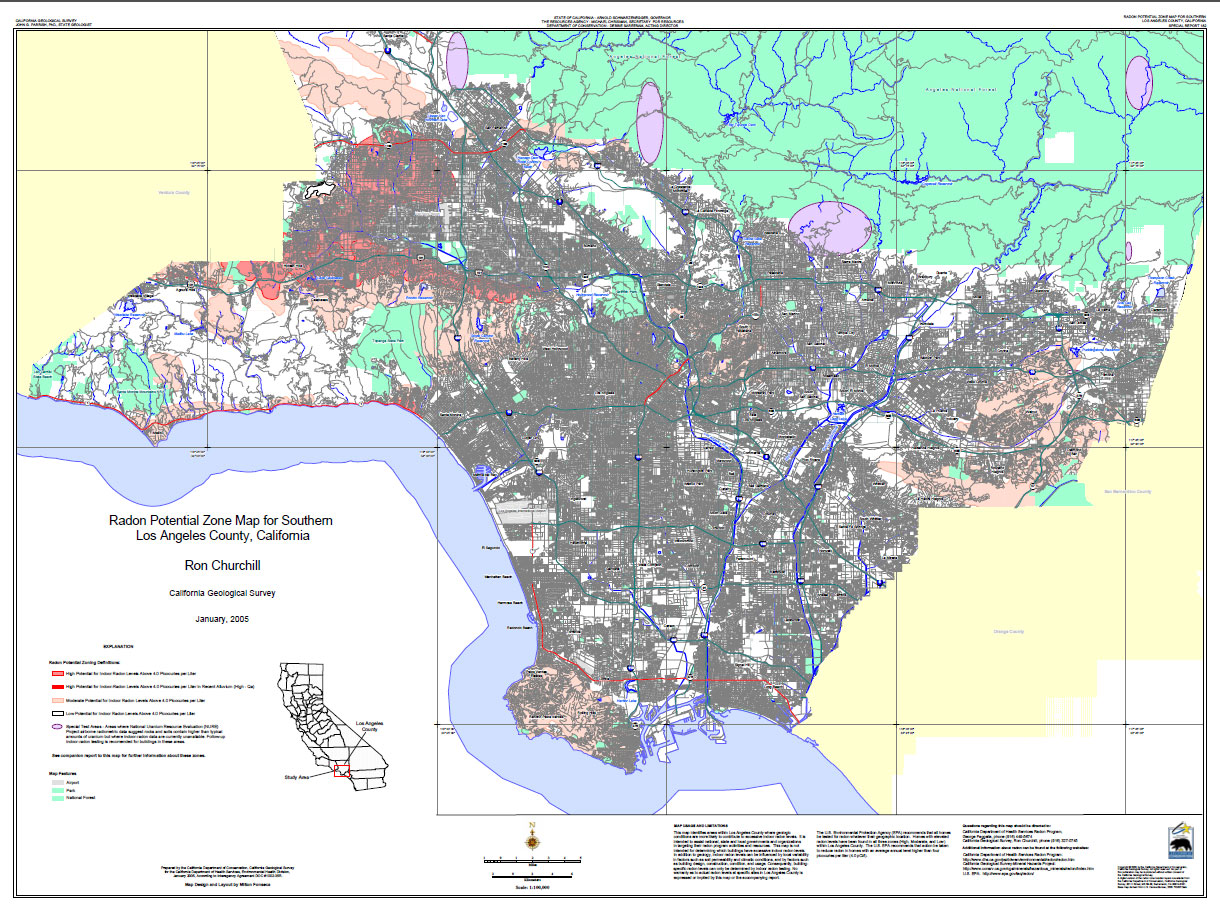
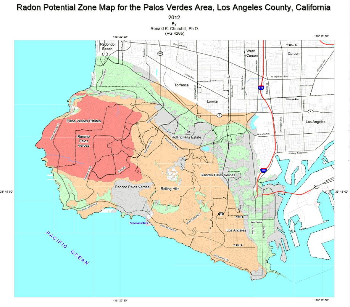
Palos
Verdes Area

There
is an interesting story behind the Palos Verdes Radon
Map.
12/2/02,
according to the USGS radon web page:
High School Science Project Leads to Federal Radon
Study in California
What began as 15-year-old Lauren Fukumoto's high school
science project last spring has expanded to a USGS study
of the geologic causes of indoor radon in a school district
south of Los Angeles that might have implications in
other populated areas of California. Radon, a colorless,
odorless toxic gas occurs naturally in rocks, soil and
ground water through the decay of uranium. It can damage
lungs and contribute to lung cancer especially in enclosed
areas like buildings. As part of her project, Lauren
and her father Joseph measured radon levels in classrooms
of 17 schools in the Palos Verdes Peninsula Unified
School District. They found that more than 10 percent
of the classrooms had radon measurements exceeding the
USEPA action level and more than half of the schools
had one or more classrooms above the action level. Three
schools had particularly high levels of indoor radon
in numerous classrooms, and the school district has
taken steps to correct the problem. Working with geologists
from USGS, the Fukumotos identified the likely source
of the radon as a particular part of the Monterey Formation,
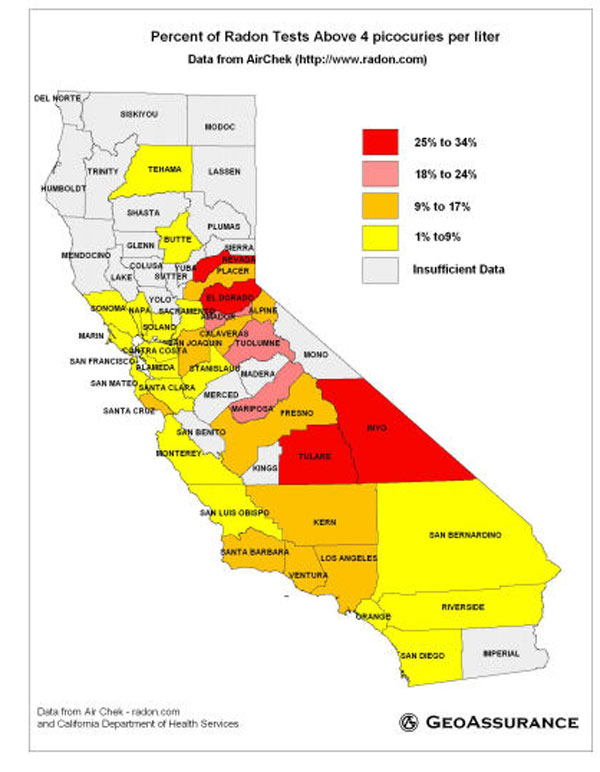
which occurs at many other places in California. Earlier
predictions of indoor radon levels suggested that the
problem was minimal in the state. These new scientific
results show that geologic maps can form a basis for
more accurate predictions of elevated indoor radon and
have prompted new examinations of data that suggest
that other rocks in California are also likely sources
of elevated indoor radon. For more information, call
Joseph Duval at 703-648-6106 or email at jduval@usgs.gov.
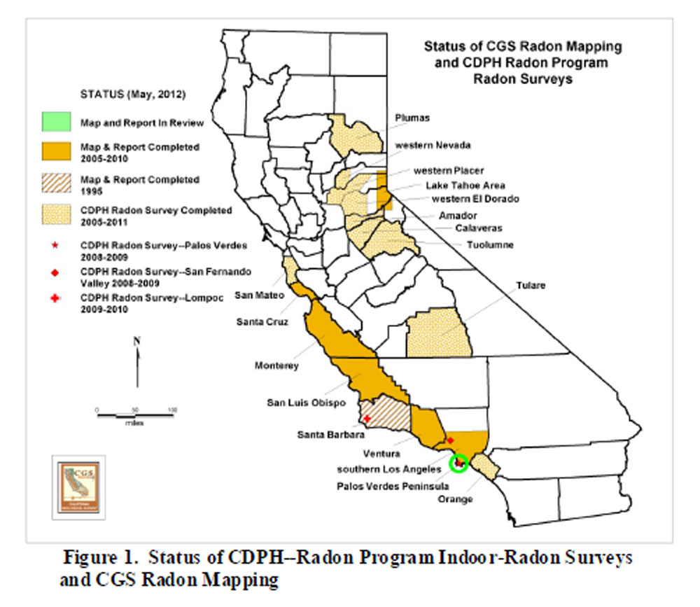
California
Geological Survey followed up with a Radon Survey of
Palos Verdes in 2011 and in 2014 (December 15, 2014)
they will hold a community meeting to discuss the map
and survey result with residents on the Palos Verdes
Pennisula.
Click
here to
view the meeting announcement.